
3 pm Workshop: This is very interesting!
The city acquired three derelict properties in 2020. It’s these three:

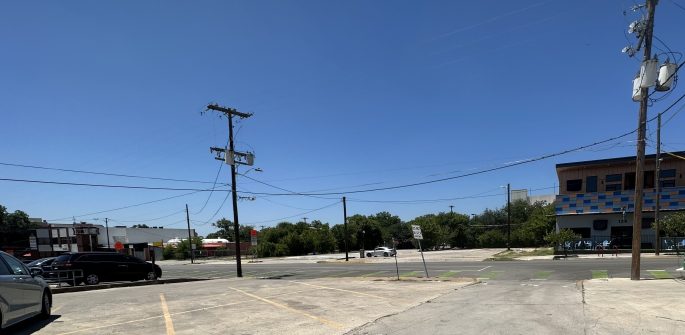
You can totally see it from the town square. It’s very close.
It looks like this from ground:

That is The Rooftop to the right, and to the left is Solid Gold used to be. (Let’s have a moment of silence for the closure of that store.)
The city bought it because there were a bunch of contaminants in the ground. It had been a dry cleaners for years and years. From the late 1940s-1980s, they were dumping some awful stuff into the ground.
So what do you do with a bunch of toxic shit in the ground? There are procedures, it turns out. You need some information:
- What contaminants exactly got dumped?
- How far underground has it spread? How deep is it, and how far north/east/west/south?
- Is it staying put? Or is it moving?
- How exactly do you clean up these chemicals?
- If you don’t clean up these chemicals, what do they decompose into, and how long does it take for it to decompose?
It turns out we have answers to all these questions!
- The chemicals:
Tetrachloroethene (PERC)
Trichloroethene (TCE)
Vinyl Chloride (VC)
Chlorinated solvents are synthetic chlorinated chemicals, I’m told. Bacteria won’t touch them, but they’ll break down on their own over time.
I have no background in chemistry, but if the chemists tell me to stay away from these, I’m going to believe them.
- Where are these nasty chemicals currently?
We dug a bunch of different types of wells:

I’ll explain the “MSD” acronym in a bit.
So here’s what you find when you drill down:
- The normal soil or whatever on top. Very dense silt and clay. No moisture.
- About 22’-23’ down, you get fine sand. It’s got groundwater in it. That’s called silten clay.
- Below that, you get Navarro Clay. The Navarro Clay is super thick and water doesn’t pass through it. (The vocabulary word is aquitard, which sounds like an insult but isn’t.)
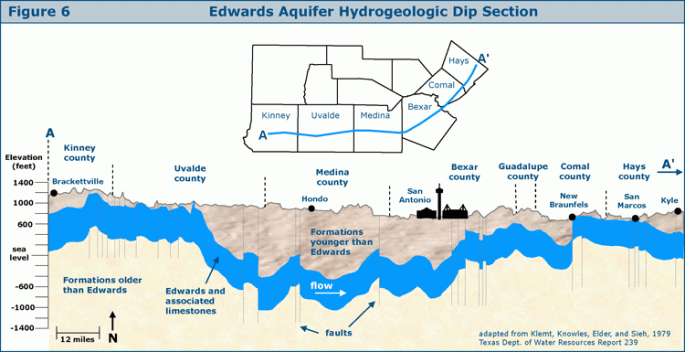
The Navarro Clay is a shield, and then below is the aquifer water.
So the contaminants – the PERCs, the TCEs, and the VCs – they are all heavier than water, and they sink through all that wet sand and puddle on top of the Navarro Clay. That tells us how deep these things are.
Note: the geologists made it sound like the aquifer was hundreds of feet further below the Navarro Clay, so far away that we should sleep easy at night.
But this makes it look not-so-far-away:
So we are really trusting the aquitardiness of that Navarro Clay.
What about how far north/east/south/west?
The skinny red line is the boundary of the PERC plume:

And here the TCE plume:
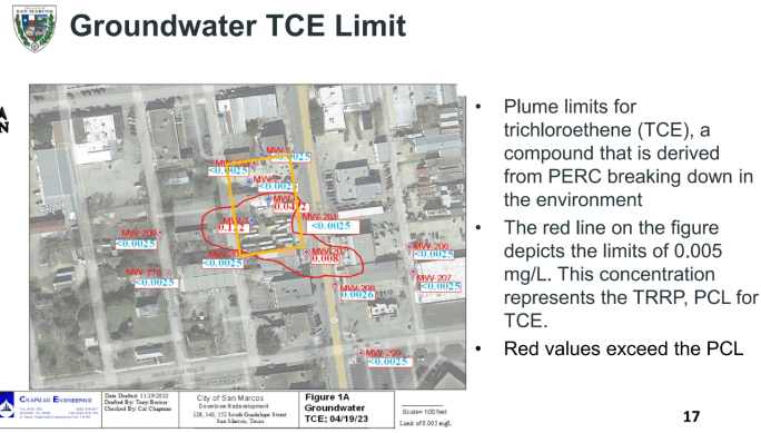
And the VC plume:

- Is it staying put? Or is it moving?
It is moving incredibly slowly in this direction:
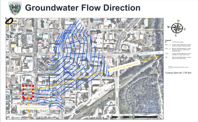
Because it’s resting on the Navarro Clay, and it’s all gunked up in there, it’s moving incredibly slowly. It won’t reach Purgatory Creek for another 89-8900 years. It won’t reach the San Marcos River for another 188-18,800 years.
- How exactly would you clean this up?
They didn’t actually answer this. They basically said it would be impossible, because of all the sand in the way, and the gunkiness of the Navarro Clay.
- What would it decompose to?
The PERC is the stuff that was dumped by the drycleaners. The PERC breaks down into the TCE, which is also nasty. The TCE breaks down into two dichloroethylenes, also bad. That breaks down into VC, still bad. But then after that you get carbon dioxide, a little chlorine, and water, which is not nasty anymore. This process will happen over the next 50-100 years.
Listen: I am sharing what was presented. I am not a scientist. If you are a scientist, and we are being told an overly optimistic picture, please fill me in.
So what do we do?
So if the PERCs and TCEs and VCs will all break down before they reach anything sensitive, what do we do?
You declare an MSD: Municipal Settings Designation.
Back to this slide, which has the perimeter of the MSD:
This means that within these borders, no one is allowed to drink well water. Everyone has to be on city water.
It also means that within a few years, we can “achieve regulatory clearance”.
Congratulations! You have nasty stuff in the ground, but your regulatory conscience is clear!
…
So what happens up top, where people wander around? This was the second half of the presentation.
Again, this is what it looks like:
It’s fine, as long as you don’t dig up that concrete.
We’re proposing a short term plan: the left and right would be city parking, and the middle will be a little public area. Shade, seating, bathrooms, bike and scooter parking. Room for extra booths for the farmer’s market or Art Squared.
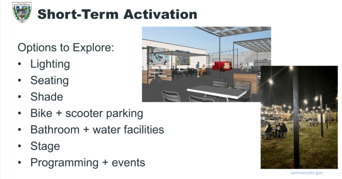
Council was nervous about having a stage there, but liked the rest of it. So this will come back around as an agenda item in the future.

I am an environmental scientist, and I don’t think I can give any better light on the issue than what you presented. The TCEQ does have a cleanup program: https://www.tceq.texas.gov/remediation/dry_cleaners but if the problem “goes away” before it reaches any waterbody, then I would be inclined to agree that “do nothing” is the most reasonable approach.
I’m still a proponent of a parking garage downtown, and this would be an ideal location.
LikeLike
I didn’t know about the dry cleaning program! The presenter was definitely steering the message towards “let it be”, but I agree with you – it seemed to add up in a reasonable way.
The problem with parking garages is that they’re wildly expensive. I don’t think the city has the funds to do one.
LikeLike